


|
WAD BEN NAGA
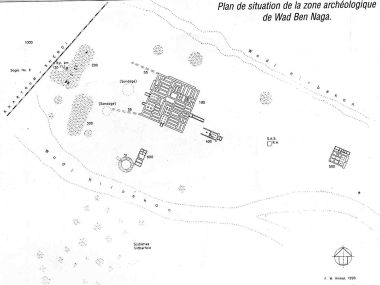
Since 1844, the Prussian expedition directed by Richard Lepsius confirmed the importance of the site by the objects found. A barque stand, today in the Museum of Berlin, confirms the names of the king Natakamani and of the queen Amanitore (around the beginning of our era). The double text, presented in Egyptian as well as Meroitic hieroglyphs, played an essential part in the understanding of Meroitic writing. In 1958, Jean Vercoutter began the first scientific excavations. They were carried out on four hillocks, revealing a large building of square plan, a circular structure and two small temples. The large building was the residence of the queen Amanishakheto (end of the I Century BC), and is thought to have had a first floor. It is still possible to distinguish on the ground floor some courts and some sixty rooms that appear to have been storerooms. This palace, similar in conception to that of king Natakamani (20 BC and 15 AD) at Jebel Barkal, had access ramps, a colonnaded atrium and decoration, as suggested by some fragments. Some fifty metres to the south of the palace, the circular structure with a diameter of 20 m is enclosed by a brick wall 3.70 m thick and 5 m tall. Could it be a hafir, a place for storing rain water? It adjoins remains of very eroded storerooms. The nearest of the two small buildings to the east of the palace may have been a temple with pylon. The second has the characteristics of Egyptian sanctuaries (pylon, hypostyle hall, intermediary rooms, and a sanctuary with lateral rooms). To the west two unexcavated hillocks extend over some 80 m and could correspond to a temple dedicated to the goddess Isis and to a mammisi, a place of divine birth. Unfortunately, this mammisi, decorated with Bes columns seen by the first explorers of the XIX Century, is today cut by the railway. Tumuli located to the north of the royal palace cover graves that post-date the Meroitic period.
|
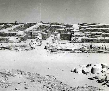    Ruins of Amanishakheto's palace (A.D.). Its surface has been evaluated about 3700 m2. The palace had about sixty rooms, several entrances and many stores. At the second floor, official and private rooms surrounded a large light well (atrium) / Arasements du palais de la reine méroitique Amanishakhéto (aux alentours de notre ère). La superficie a été estimée à 3700 m2. Le palais comprenait une soixantaine de salles, des halls d'entrée et des magasins. A l'étage supérieur devait s'ouvrir un grand puits de lumière, en atrium autour duquel s'organisaient des pièces d'apparat et d'habitation
Map of Wad Ben Naga site made by F. Hinkel. The city had several temples. One was dedicated to Isis and close to the palace of the queen Amanishakheto / Plan du site de Wad Ben Naga établi par F. Hinkel. La ville comprenait plusieurs temples dont un sanctuaire dédié à Isis et proche de la résidence de la reine Amanishakhéto
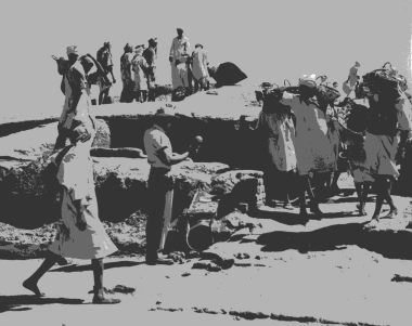
Queen Amanishakheto's palace diggings (1960) by Jean Vercoutter / Fouilles du palais de la reine Amanishakhéto par Jean Vercoutter en 1960
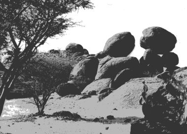
Nilotic surroundings close to Wad Ben Naga site / Environnement nilotique près du site de Wad Ben Naga
|